2026
Known as the Trails Capital of BC, Vernon offers more than 500 km of hiking, biking, walking, snowshoeing, and skiing trails throughout the region.
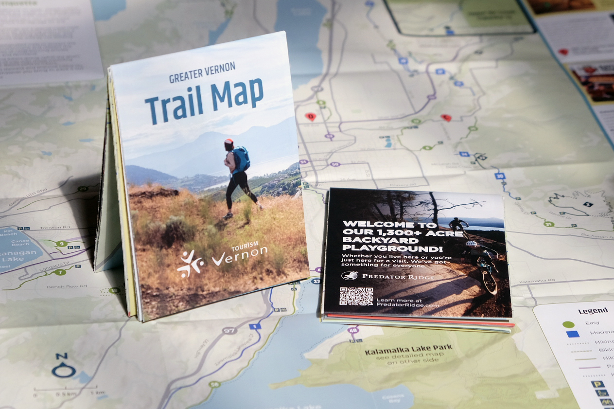
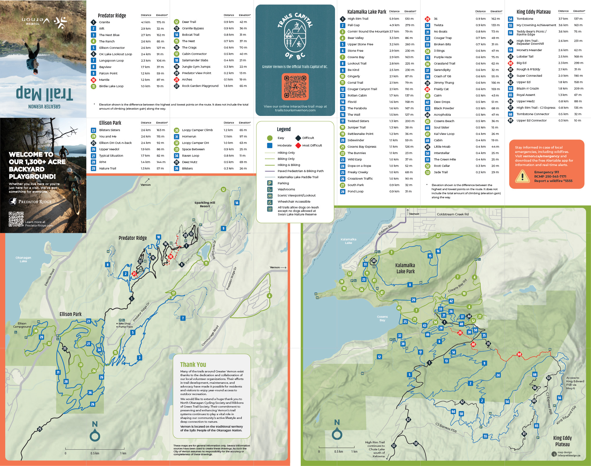
This 28" × 22" folded trail map was based on trail data from Tourism Vernon’s interactive online trail map. One side features the extensive hiking and biking trail network surrounding the City of Vernon, while the reverse side provides detailed maps of key trail networks at Predator Ridge, Ellison Provincial Park, and Kalamalka Lake Provincial Park.
Tourism Vernon supplied raw GIS trail data, which I imported, organized, and cleaned up to create this print map.
Effective map design is about presenting the right information while eliminating unnecessary detail that can create visual clutter. Using Tourism Vernon’s brand guidelines as a foundation, the map incorporates consistent typography and colour palettes to create a clear and cohesive user experience. A subtle hillshade background adds terrain context without competing with the trail information.
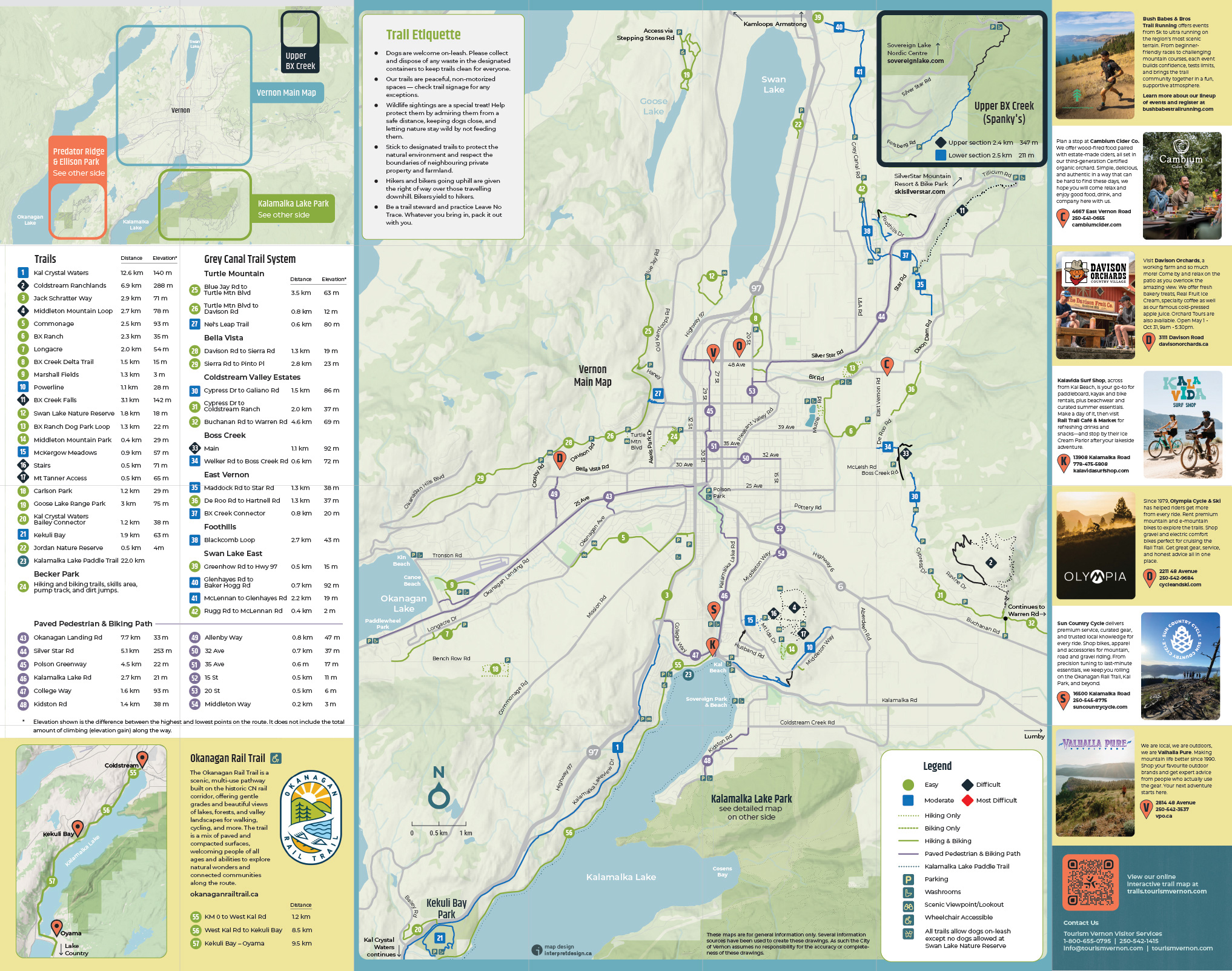
The map highlights hiking, mountain biking, and paddling opportunities throughout the region, along with key amenities such as parking areas, washrooms, scenic viewpoints, and accessible trails. Trailheads and destinations are easy to identify through a combination of icons, colour coding, and clear labeling.
Local business advertising is listed along the right side panel and each participating business is identified with a location pin on the map.
Several inset maps provide detailed views of popular recreation areas, including the Okanagan Rail Trail and the Upper BX Creek (Spanky's) trail network.
Each trail is assigned a number and difficulty rating that corresponds to a detailed trail directory. Trail listings include distance and elevation gain to support trip planning and navigation.
Most of the maps I design end up on large trailhead signs, so it was a nice change to work on a folded paper map that people can tuck into a backpack or glove box. The goal was to pack a huge amount of trail information into a format that feels clear, approachable, and fun to explore.